GNSS (GPS) Surveys
Global Navigation Satellite SystemsUsing the latest Global Navigation Satellite Systems (GNSS) tracking both GPS and Glonass satellites we are able to plot surveys to Ordnance Datum Newlyn by means of the Ordnance Survey Geoid Model (OGSM02)
As Ordnance Survey no longer support the Bench Mark network, GNSS is the only reliable way to obtain an Ordnance Datum and must be used when carrying out a Flood Risk Assessment for development work.
The use of GNSS survey instrumentation also means we are able to plot the survey to either site centered or full Ordnance Survey National Grid coordinates.
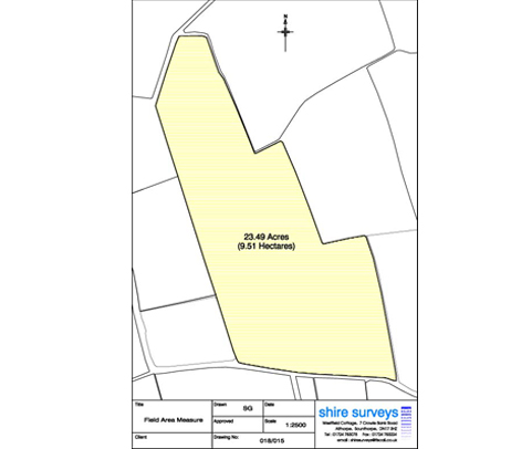
GNSS (GPS) survey equipment can also be used to efficiently survey very large areas. This is particularly useful for measuring cropped and farmed field areas for DEFRA submissions supported with clear drawings and plans.
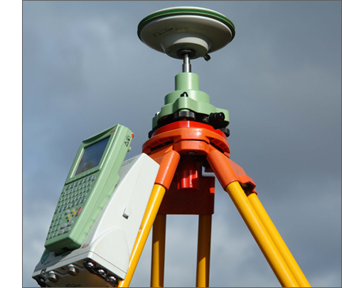
GPS equipment
A typical field area survey